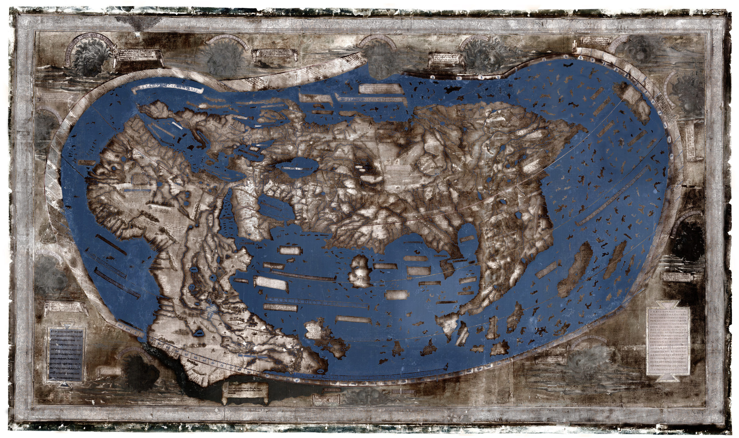
Chet van Duzer’s Multispectral Image of Beinecke Library’s Martellus World Map, Yale, Beinecke Library, Art Storage 1980 157.
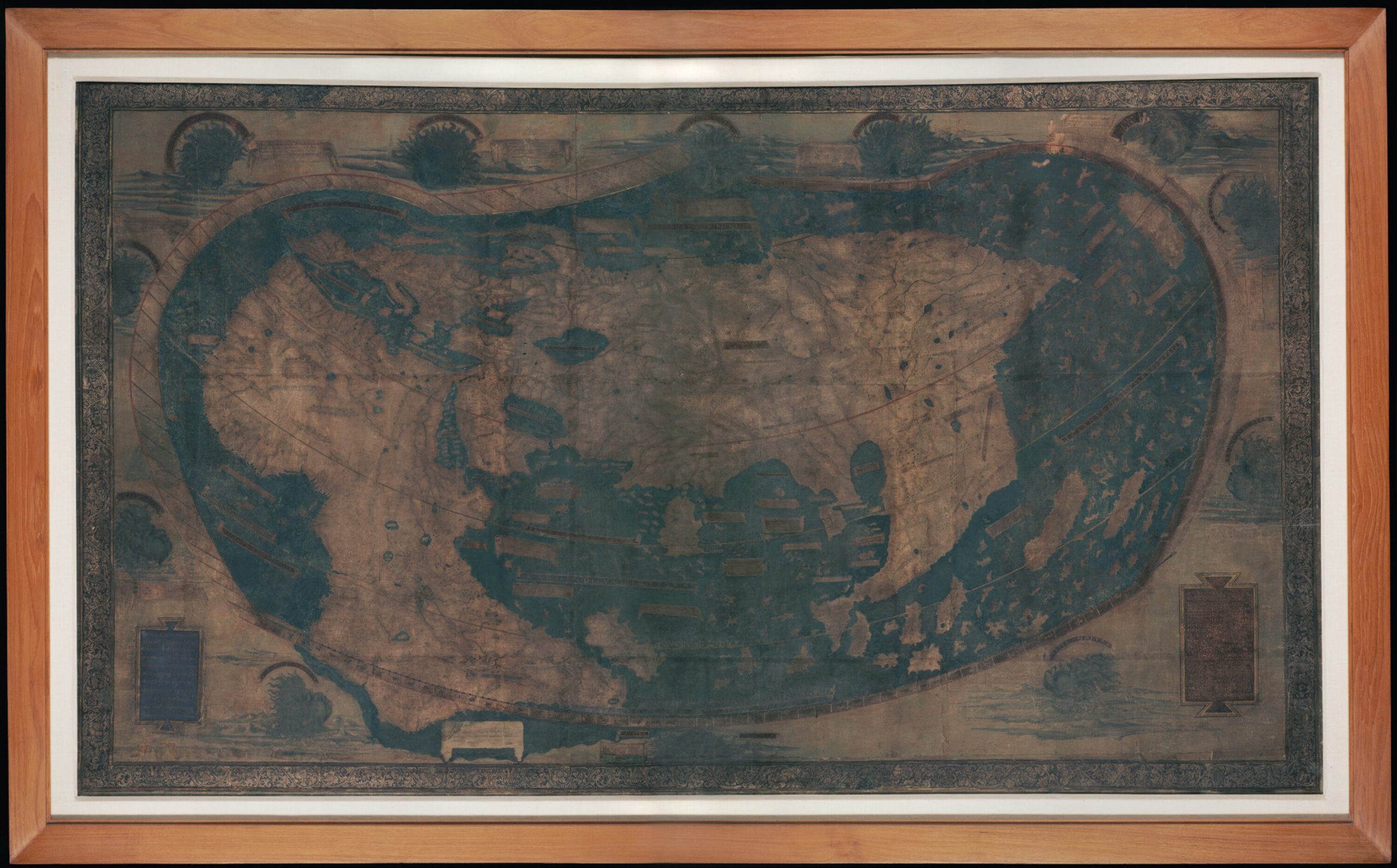
Photograph of the Martellus World Map at Yale without any color or image correction. Note that the frame was removed for the multispectral image. Yale, Beinecke Library, Art Storage 1980 157.
When one compares the two maps, one can readily see that the text in the banderols has become almost impossible to read in many cases. These banderols often contain the names of the regions or geographical objects and sometimes contain explanatory texts. For a map such as this one, which is believed to have been composed just before Columbus’ first journey, the significance of the map for understanding the age of exploration is considerable. There are, however, some costs associated with multispectral imaging. For one, it requires special equipment, both cameras that are able to take images that have been taken under light spectra invisible to the unassisted eye, and software that compiles these images in order to make them useful for study. While the Beinecke Library Digital Studio has a camera capable of taking multispectral images, it has not, to my knowledge done so. One possible reason might be lack of experience with new technology; advocating for training thus might be a necessary part of introducing this technique on academic campuses.
Training:
Useful articles on multispectral imaging: